It was a curious field of battle for opening of the Revolution: 20 miles of winding, hilly road connecting a port city and several country towns. But word of the fighting on Lexington Common, at Concord Bridge, and on the road to Boston raced throughout the American colonies to unite men and women behind the patriot cause. What had begun as a struggle between British authorities, determined to enforce the will of Parliament, and the people of Massachusetts, just as determined to retain their as English citizens, soon escalated into a war for independence which lasted more than eight years. Much of that country road is now an urban highway, but the Battle Road still follows generally the same route, passing the sites of the bitterest fighting and the buildings that stood nearby, helping recall the dramatic events of April 19, 1775.
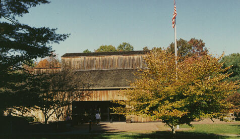
Many visitors begin their tour with the film and map program at the Battle Road Visitor Center.
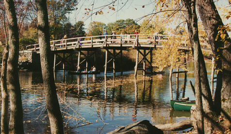
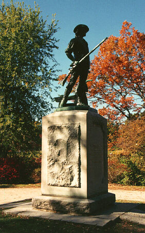
The North Bridge Area. The North Bridge, where the "shot heard 'round the world" was fired, was the site of the first effective forcible resistance to British rule in America. Visitors can cross the North Bridge and see the Minute Man statue. The North Bridge Visitor Centeroverlooks the site.
The Wayside. Samuel Whitney, muster master for the Concord militia, lived in the Wayside during the Revolution. The house later was the home of literary figures and performers, including the Hawthornes, Alcotts, and Lothrops.
Meriam's Corner. The Meriam House and barn gave cover to the militia, allowing them to get close to the British column as it crossed the narrow bridge there. The shots exchanged between the colonists and the British rear guard opened the running battle on the road to Boston.
Hardy's Hill. Militia from Sudbury and towns to the south joined the fighting at Hardy's Hill, where the British were subjected to fire from both flanks.
Bloody Angles. The Battle Road made two sharp turns after Hardy's Hill, providing ambush points for the Woburn militia and others. The British, exposed to a murderous crossfire, lost eight dead -- thus the name "The Bloody Angle." Here they realized how desperate was their situation.
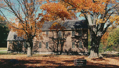
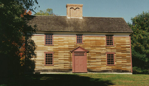
Hartwell Tavern. In 1754 Ephraim Hartwell opened a part of his home as a tavern, where travelers were provided bed and board. It was also a popular gathering place for local people.
Capt. William Smith House. This restored 18th century house, typical of its period, was the home of the Captain of the Lincoln minute men.
Paul Revere Capture Site. Paul Revere, Dr, Samual Prescott, and William Dawes were confronted by a British patrol as they rode to warn Concord of the approaching British column. Revere was captured and Dawes was forced back to Lexington, but Prescott escaped to carry word of the British march to Concord.
The Bluff. A small rocky hill along the Battle Road presented a significant obstacle to the British while it was held by the colonials. The column appeared trapped until Major Pitcairn sent a detachment to occupy the high ground while the column moved past and reformed.
Fiske House Site. The area around the house of Ebenezer Fiske was the scene of intense, close-quarter fighting, as British flankers tried to flush out the concealed ambushers. The historical park ends here, but the fighting continued on through Lexington, Menotomy (present-day Arlington), and Cambridge until the British reached Bunker Hill.
-- Text from USNPS brochure --